
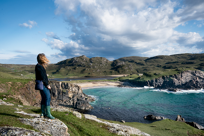
Travelers usually head south to Harris to find the prettiest beaches on this island, but those in the know can find equally beautiful beaches on the western side of this isle…such as Uig Sands, Reef Beach and Dalbeg Beach.
Thanks to social media, it’s easy to spot a dramatic pic on Instagram and vow to go there. But, beware. Some beaches are so remote that you may never find them. Distances are farther than you think on this island due in part to traveling slow on the extremely narrow single track roads, the lack of signage, and roads that seem to simply “end” without arriving at your intended destination. At least that was the case for us —especially when we tried to find Mangersta.
But, if you’re staying anywhere near the Callanish Stones on the western side of Lewis, the closest and easiest beaches to find are side by side, Dalmor and Dalbeg. The most popular one, Dalmor, has a wide expansive sandy beach that would be a great place to fly kites. It also attracts experienced surfers who brave frigid waters to ride big waves rolling in from the Atlantic. This beach is geared more for tourists with a large parking space and toilet facilities.
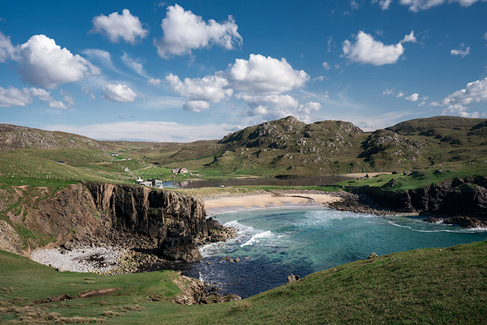
But my favorite was Dalbeg Beach, just .89 miles north. Smaller and secluded, this enchanting hidden cove has rocky cliffs that beg to be explored. Come here and you may find you’re the only ones visiting on any particular day.
Dalbeg Beach

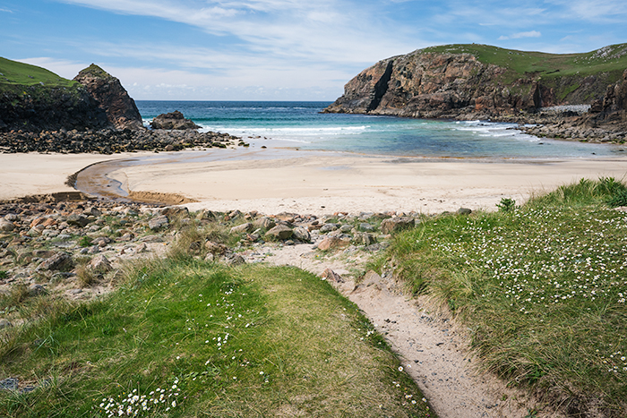
Getting to Dalbeg Beach: From Callanish Stones it’s a 20 minute drive north. In Carloway, travel north on A858 along the paved coastal road for 2.8 miles, approximately 5 minutes. Then go very slowly to spot the Gaelic sign Traigh Dhail Beag. This is erected at the very point where you’ll need to turn left to access the narrow single-track lane that passes through machair for .6 miles to reach the small parking area. As you near the beach note the little contemporary building on your right. It houses a small art studio, The Beach House Gallery, that is open most afternoons. The couple also rent a modern studio apartment by the week for couples wanting to stay near the beach. (Be careful on this tiny lane. We drove too close to the edge and ended up getting stuck in the muck. Luckily there was another car approaching and the driver helped us push our car out.)
At the parking area there is a picnic table on the right. Note a sign here marking the open trail up the hillside (heading north). This is part of the West Coastal Path. (The 12 mile trail actually begins south at the Gearrannan blackhouse village, heads north to Dalmor Beach, and passes through this beach and ends in Bragar. See more info below.) But instead of doing the entire walk, you can explore the hills to the right or left and return to the carpark. Or forget the cliffs and simply head to the beach itself.

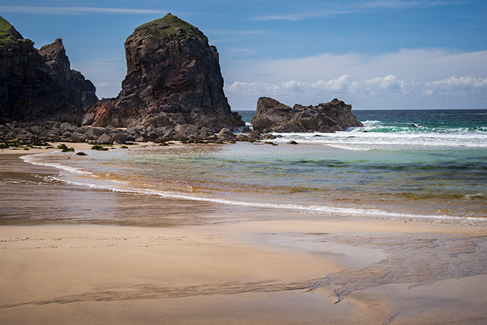
It is best to wear Wellies—you may have to cross a small stream that flows from Dailbeg Loch to this beach or cross wet slippery rocks before reaching this shore. Check online for the tide schedule before your visit. At low tide you can supposedly see a natural sea arch on the right side of the beach.
Exploring Hills to the South
There’s no specific trail. Just start walking up the grassy hillside the left of the beach. If you kept going south for a mile you’d reach Dalmor Beach.

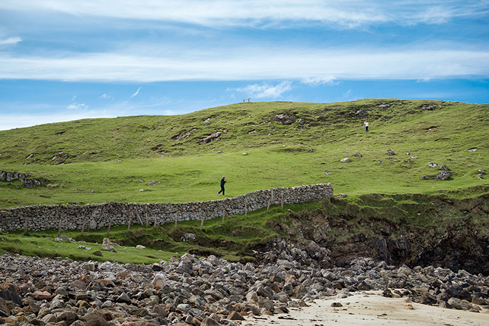
There is an old stone fence and remnants of an abandoned stone building that you can explore. A bench at the very top of the hill indicates the walking trail which is otherwise not marked.
On the other side of this southern hill you’ll see another a tiny cove….with many stacked rocks.

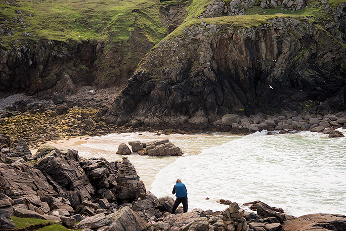
No idea why… they don’t mark the trail which is way up high on top of the hillside.

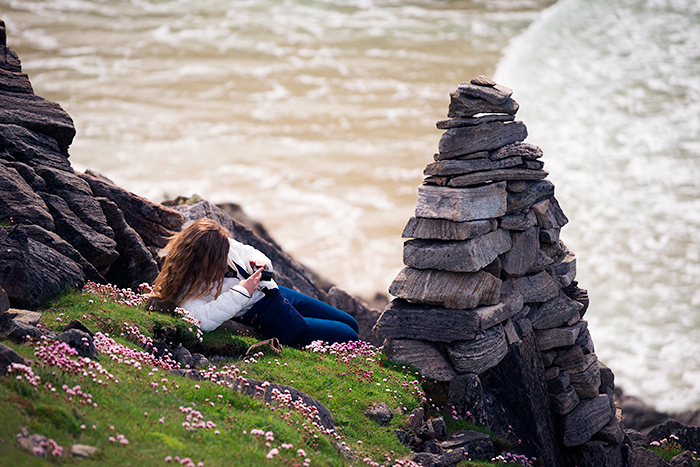
No idea what this little stone structure represents…
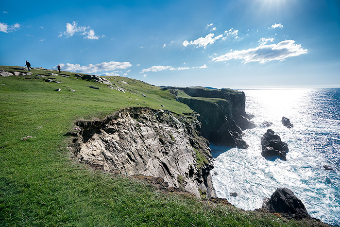
Looking back to the right, the giant cleft in the cliff is the northern coast that hikers pass over on the West Coastal Path.


Beautiful and mesmerizing!
Loved sitting at the top of this grassy cliff watching the incoming tide crash against those ancient gneiss rocks.

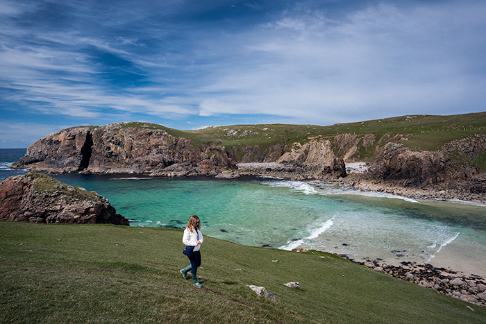
Leaving the south hill (end section of the West Coastal Walk from Dalmor to Dalbeg). Such an idyllic little bay!
If you want to bring a picnic here, drive up the road to North 40, a food shop in Bragar where you can grab a gourmet lunch or dinner box. We tried, but weren’t so lucky to find it open on either of our two attempts.
WEST COASTAL PATH
Exploring Hills to the North
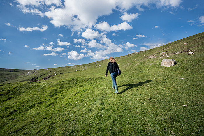
Another day my daughter and I returned to hike part of the West Coastal Path. I really wanted to find the natural sea arch known as Stac a’ Phris, and studied Google Maps which indicated we’d surely see it if we simply continued north. So off we went!

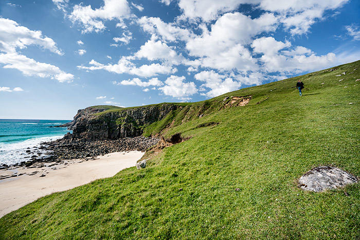
You can faintly make out the fence posts which are the route markers on this coastal trail.

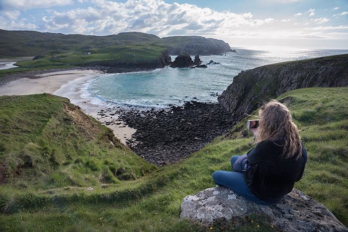
Overview of Dalbeg Beach from the top of the hill.

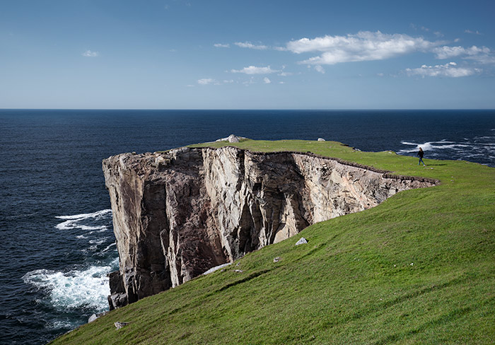
About 25 minutes later we arrived at a flat grassy peninsula that jutted out over the sea.
Felt like we were walking out to a tricky putting green on the 18th hole of a golf course.

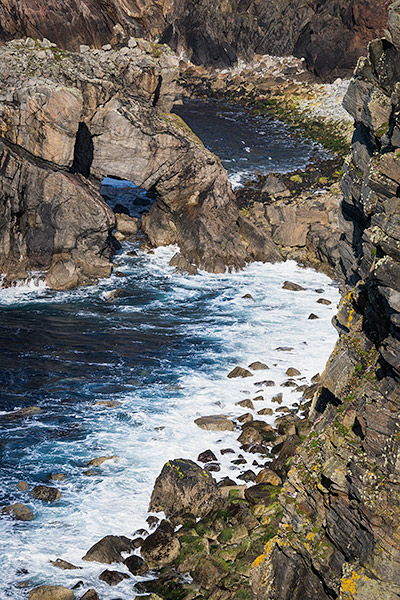
To the north of here was a rocky cove. I looked for the sea arch –but didn’t see anything other than this. Yes, it’s technically a sea arch but nothing like the pictures I’d seen.
The online description of the Coastal Path reads “The cliffs are dramatic at this point. Stac a’ Phris has a large natural arch that can easily be viewed from the north and is a nesting ground for gulls and kittiwakes in late spring and early summer.” We certainly saw lots of birds flying around…but no arch. Maybe not visible from the south.

But seeing it from the north wasn’t possible—there was a stone fence with no stile to get over. Apparently we should’ve gone straight up the interior and not followed the coast as it led to a dead end. (Good thing we hadn’t arranged for David to pick us up at the end of this trail!) So, we had not choice but to turn around and follow the clifftops back toward the carpark. Be careful not to get too close to the edge of these sloping cliffs!

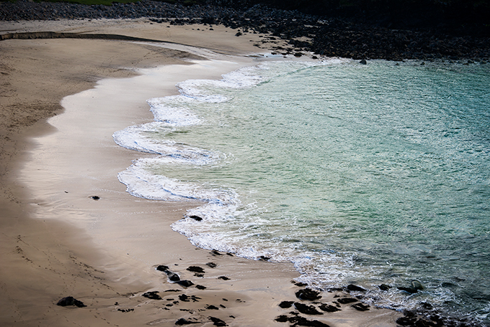
Interesting flower petal-shaped waves!

Admiring our final view of at Dalbeg Beach—a pretty scene at the end of another great day.
This was taken at 7pm. Sunset wouldn’t add its magic for another four hours, as summer sunsets happen around 11pm.

Wanna explore more?
West Coastal Path 12 miles, 7 hours one way
If you want to hike the entire route allow an entire day. The trail begins at Gearrannan blackhouse village, passes through Dalmor and Dalbeg Beach, and ends at Bragar. The cliffs between the blackhouses and Dalmor are especially steep. This section takes 1.5 hours, and the walk from Dalmor to Dalbeg is 40 minutes further. The entire hike is divided into 8 sections. Study the descriptions on the WALKHIGHLANDS website for complete information regarding fences and stiles to navigate along the path.
WalkHighlands describe the hike as “Infrequently waymarked, with some navigation required. Much of the route is pathless; some rough going and boggy ground.” They claim public transport is available at both beginning and end but I would try to verify, as we did not see any buses running in early June anywhere on the island (except coaches visiting Callanish stones in tour groups).
And I’d recommend carrying a little hiking guide rather than relying on the internet out here.





Alison Cloonan - I didn’t know there was such great beaches in Harris, thankyou fir sharing
Kim - Yes, so many beautiful beaches all along the coast! Dalbeg happens to be on the Lewis side of the island but Harris has plenty of similar options.