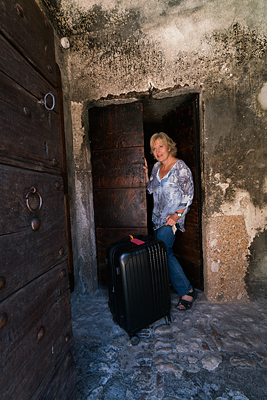
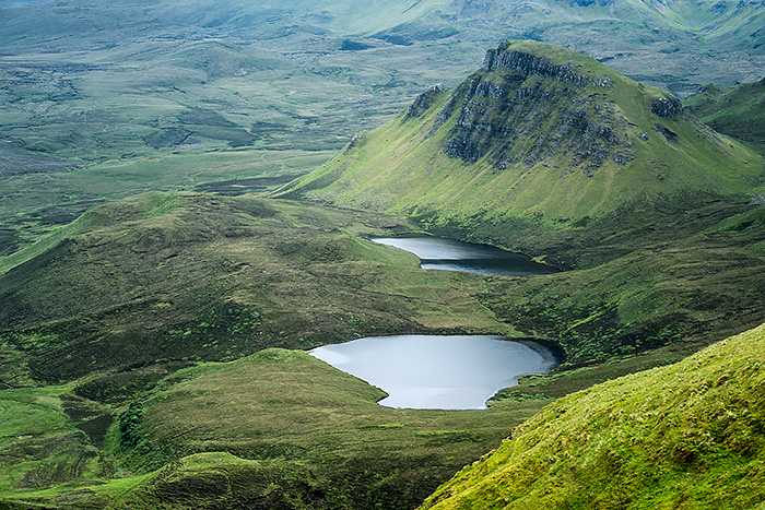
Humming Over the Sea to Skye, the haunting melody played in the Outlander time travel series, I closed my eyes thinking about visiting the Callanish Standing Stones the night before on the Isle of Lewis. Like Claire, in the Outlander, I too had touched the largest stone in the circle, feeling the roughness of the ancient gneiss rock under my hands. And now, here I was, acting out the lyrics and sailing across the same waters heading “Over the Sea to Skye.”
History of the song Over the Sea to Skye
The 19th c. Scottish ballad Over the Sea to Skye is about the journey of Bonnie Prince Charlie. He hid on tiny islands to evade British Red Coats who wanted him dead after his Highland supporters were killed in the 1746 Battle of Culloden. His young lover, Flora MacDonald, helped him escape. She dressed him up as her maid, Betty Burke. Nervously, they sailed from Bernberla Isle, near Lewis Isle, in the Outer Hebrides to the Isle of Skye with 6 sailors in a small boat.
The disguise worked. When Bonnie Prince Charlie and Flora landed on the northern shore of Trotternish Peninsula, they hid out at Lady Margaret’s property in Kingsburgh before he sailed onward to France. Sadly, Flora never saw him again. She was arrested and imprisioned in the Tower of London a short stint for her actions to save the Prince. Eventually she married another man, had 7 children, and at age 67 was laid to rest on the northern coast near Duntulm Castle. Clearly she had a full life but never forgot the Prince. Legend claims that Flora’s family honored her request to be buried in the Prince’s unwashed bedsheets that she wrapped in lavendar and kept as a momento when he left for France.
Lyrics in the Over the Sea to Skye song, or Skye Boat Song, were written to an old Gaelic rowing medody. Sir Harold Boulton created the first set of lyrics in the 1870s, but poet Robert Louis Stevenson made them “more harmonious” in 1855. The sad evocative melody mourns the loss of Jacobite lives in the failed uprising and the loss of their culture –as kilts and Gaelic were prohibited in the Scottish Highlands after they lost the war–but also alludes to hope. This ballad has not only remained a popular Scottish folk song since 1870, but also inspired musicians worldwide–from Rod Stewart, Tori Amos, James Galway & the Chieftains, Canadian punk rock band The Real McKenzies, and Bear McCreary who’ve recorded their own renditions.
Over the Sea to Skye was our Wedding Song
Years ago, when David played an instrumental version of this song as a possible choice for our wedding day, I was instantly smitten. The haunting melody sounded mystical, romantic, beautiful…
So on our wedding day, I walked down a forested ‘aisle’ to this Scottish ballad. Cellos, acoustic guitars and bagpipes played as I wed David under a canopy of oak trees.
Although we honeymooned in Egypt and Jordan, we vowed then to visit Scotland, and the Isle of Skye, someday. Ten years turned into twenty. Twenty??!
What better time to visit than our 20th wedding anniversary?
My husband, teenage daughter and I planned a trip to Scotland for late May to mid June. We spent 4 nights on the Isle of Skye, concentrating our time on Trotternish Peninsula in the far north instead of following online guides to cram in “All Skye Sites in 3 days.”
Ferry Crossing Over the Sea to Skye

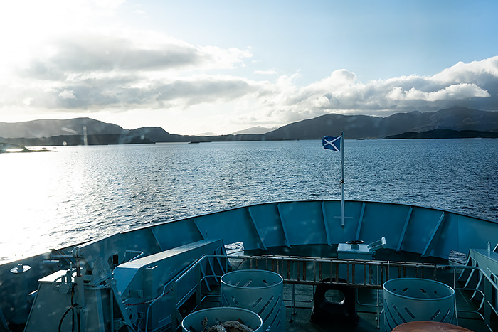
We took the sunset cruise on the HV Hebrides operated by Calmec Ferry from Tarbert, Harris on the Isle of Lewis to Uig port in Trotternish Peninsula in the northwestern part of Skye. The ferry has 1-2 departures per day depending on the day of the week and season, and must be reserved far in advance if you take your car.
Comfortable and spacious, these large ferries have plenty of room to roam around inside and on the outer deck. And a cafe on board offers hot meals and drinks. After sailing 1 hr and 45 min we arrived in Uig, found our rental car on the lower deck and drove onto Skye.
Trotternish Peninsula
The prominent feature of Trotternish Peninsula, located in the northern region on the Isle of Skye, is a high volcanic ridge. This rocky ridge stretches from the Old Man of Storr in the southeast, passes through the Quirang, and ends at Flodigarry on the far northeastern coast. The stunning geology of rock pinnacles and grassy landslides created from volcanic activity long ago make this a nature lovers paradise. Adventure seekers, hikers, and rock climbers tend to congregate here.
A paved road known as the Trotternish Loop is a 50 mile driving circuit from Portree (the island’s only town) that connects the main attractions around the coast of this peninsula. There is a shortcut across the peninsula at Quirang, but should only be attempted in daylight.
So of course our GPS directed us to follow this shortcut when we got off the ferry in Uig–since we were headed to Staffin, exactly east from here. At 10pm, black skies obscured any road signs. Our lodging host had explicitly instructed us to take the long way around the island at night. Not the shortcut.

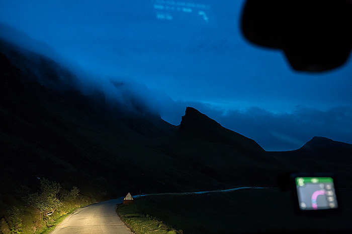
But we realized our error too late. We were already committed to the narrow road winding up the volcanic ridge and across the high plateau. We slowly made our way around the curves, dodging huge potholes. Our headlights illuminated low clouds swirling around the base of the Quirang mountains. What a eerie, spooky scene! We passed some campers parked at the Quirang trailhead, then began our descent down the hairpin turns.
Welcome to Skye. Let the adventure begin!
Our Lodging on Skye
Once we reached sea level on the opposite side of the island, we looked for the tiny crofting community of Digg, near Staffin. Our 2 BR Anmara cottage (duplex) was nestled in the shadow of Quirang in a peaceful valley facing the sea. Our friendly host, who lived near the shore, came out to welcome us despite the late hour. She provided instructions about the rental and invited us to feed her baby lamb the next morning.

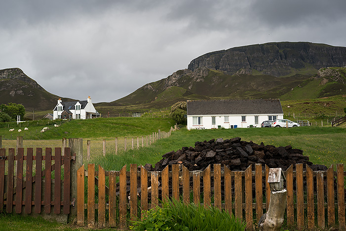
Heaps of black peat blocks are burned for heat
Our cottage, outfitted with a complete kitchen, living room and washer/dryer, had everything we needed. And the location couldn’t have been better–right off A855, the main road that circles Trottenship coast. We were just one of many white crofting cottages in this rural landscape dotted with sheep. And sheep dogs. One afternoon we watched our neighbor train his sheep dogs with whistle commands.
Elsewhere in Trotternish Peninsula, travelers can choose between 13 B&B’s, 3 hostels, 1 luxury hotel, 1 family hotel, and 40 self-catering cottages.
Dining choices tend to be quite limited. Tea shops offer pastries, sausage rolls, pie and hot beverages. Just look for signs and cars to find one open when driving on A 855. Columba 1400 cafe in Staffin serves lunch too. We couldn’t find anyplace open for dinner outside of the town of Portree. So renting a cottage with a kitchen is a great idea.

We bought most of our takeaway meals or groceries from an Indian couple at Mackenzie’s Stores. Their small building is conveniently located on A 855 at a gas station a mile or two south of Staffin. Everyday they make an amazing curry (vegetarian, fish, or meat) and fresh naan. They also stock frozen fish, pizza, meals and canned foods.
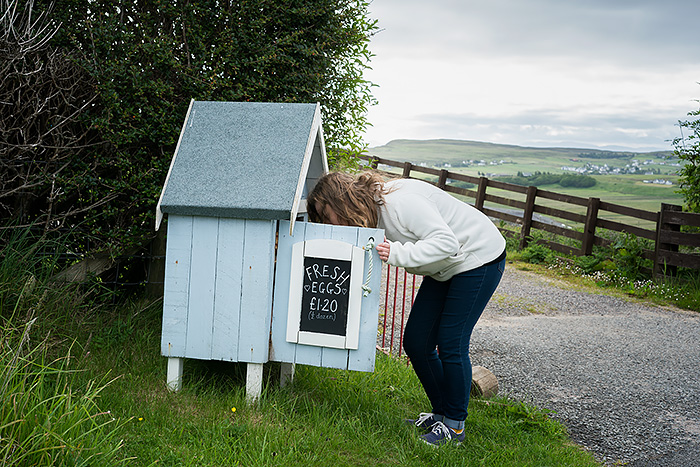
For breakfast, we gathered eggs each morning from a nearby honor box, exchanging coins for fresh eggs.

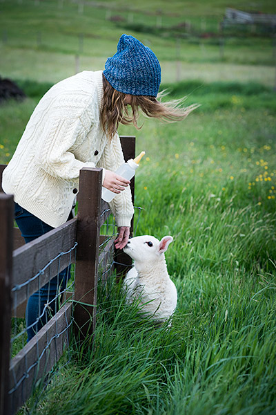
After bottle feeding the little lamb in our pasture, we drove up the same road that we drove across last night. Reaching the midway point, we parked at the trailhead for the Quirang hike. We arrived early as parking fills quickly. Plus morning is the perfect time to hike as shadows cover the entire area later in the day.
Quirang Hike

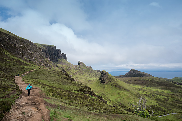
The Quirang has perhaps the most stunning landscapes of the island. This four mile trail traverses a volcanic terrain of rocky pinnacles and velvety mountains interspersed with lakes (lochs). Even though it is located in the far northeastern section of the island, both independent travelers and bus tours make the effort to get here for the jaw-dropping scenery alone.
Most visitors only walk a short distance on the dirt path before turning around. Especially those on abbreviated bus tours. Clusters of people with their cameras jam up the beginning of the trail.
Keep going!

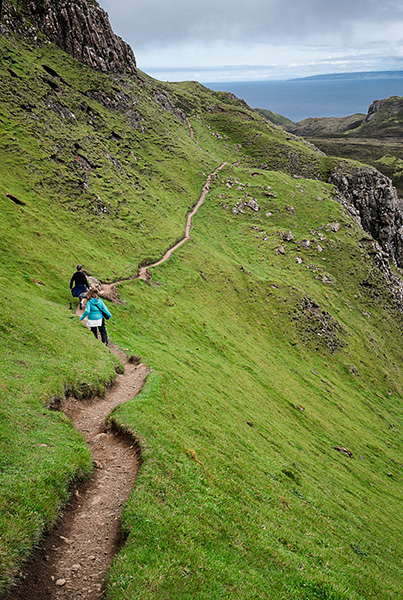
Gorgeous scenery erupts perhaps 30 minutes in… jagged peaks, lochs and landslides from volcanic activity.

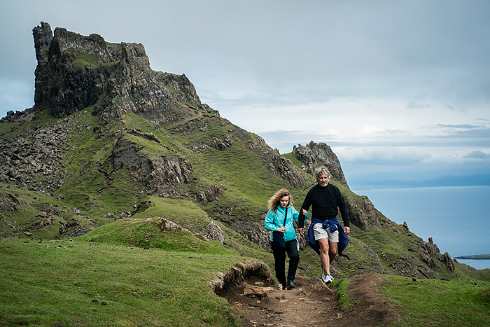
Note the winding road cutting east-west across the rocky ridge between Uig and Staffin is how you access the trailhead. (Our shortcut in the dark!)

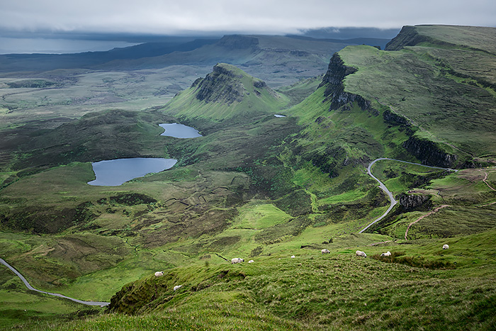
Views are simply spectacular!
Those with limited time– of around an hour — usually stop here and turn back to the carpark.
But we were in no hurry to rush to other sites on our first full day on Skye. We came to hike the entire Quirang Loop, a 7 km mountainous trail that takes about 2.5-3 hours to complete.


Although it took us much longer.

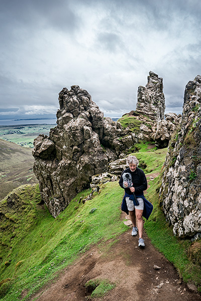
Hiking through the Pinnacles on Quirang

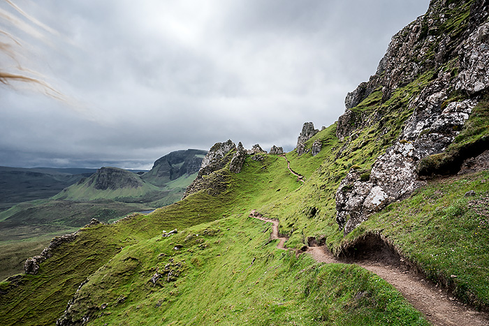
Who can blame us? So much to capture! All 3 of us stopped to take videoes and photographs along the way.

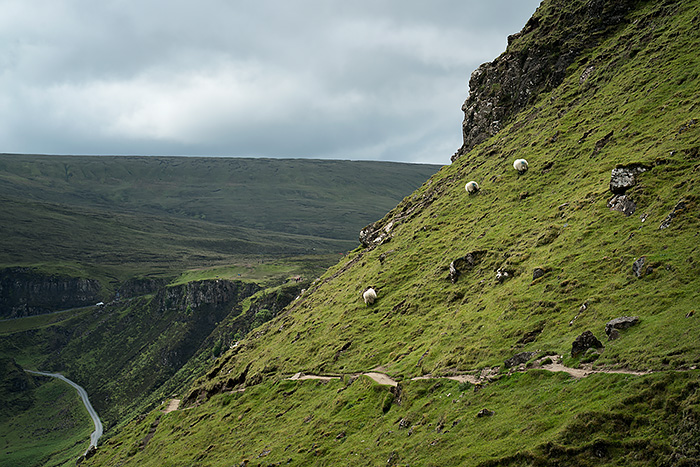 The trail kept climbing. Here you can see the trail gets pretty steep!

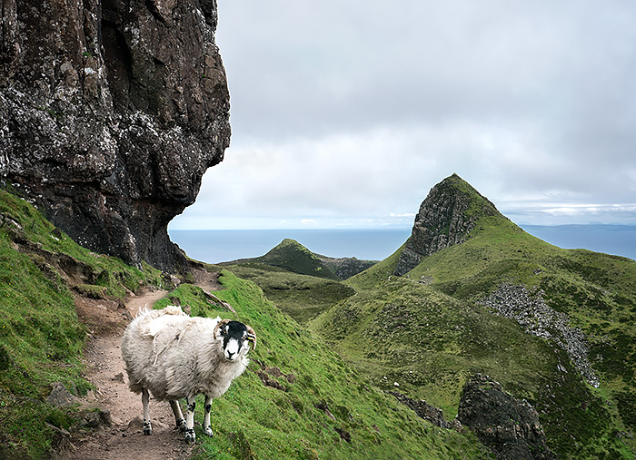
At this point, we came face to face with more sheep than we did other hikers. He looks a little suprised to see us too!

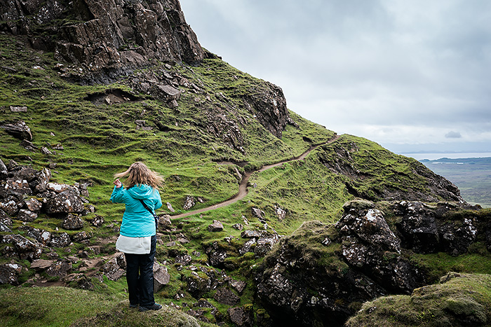 Here we crossed our first stile to continue hiking around the slope. Over the crest we came to a fork in the path. The right branch descends to a lake, Loch Hasco. We chose left to keep on the main trail, which climbs over a saddle with more pinnacles. The trail is more eroded here as it climbs up another ridge, over another stile to pass through a stoney wall.
Before long another detour presented itself. We veered right to climb up the Sron Vourlin ridge. Thankfully we had a clear day, and could see the sea and Staffin Bay beyond. (And our cottage too if we’d brought binoculars.) Careful, the wind is crazy wild here!

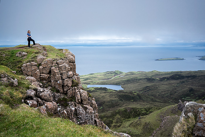
Coming down from the rocky summit, we walked out across The Table, a flat, grassy peninsula tipped up from a landslide.

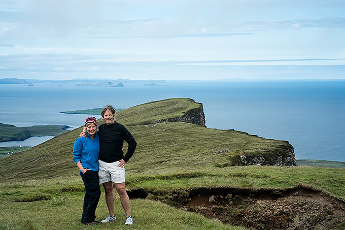
Making our way back to the main trail, we followed the path up a rather steep escarpment with more stiles and loose rocks. This section was the most difficult, and we all felt quite winded by the time we reached the top.
Then we ended up getting a little lost.
Catching our breath at the summit, we looked for the trail. But it had petered out on the final home stretch. Simply disappeared. We could only see boggy landscape–patches of dirt interspersed with grasses, tiny wild flowers and short vegetation along with mud and standing water across the entire top of this ridge. Our boots sank into the spongey earth as we crossed the bog. We plodded along knowing that the trail was a loop, all the while looking for the best route down to the carpark visible far below.
We gradually descended, crossing tiny streams and loose rocks. About halfway down, we found the clear trail again and followed this zigzagged path down to our car.
The Quirang was our favorite hike on the Isle of Skye, and highly recommend allowing half a day to explore this fascinating place.
Renewing our Wedding Vows

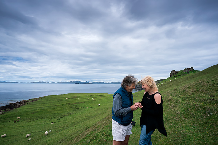
Our daughter played our wedding song, Bear McCreary’s newer rendition of Over the Sea to Skye, on her iphone as David and I renewed our wedding vows on our 20th anniversary. Other than Jordan, sheep were the only other guests to this very casual but romantic gesture on the far northern end of Trotternish Peninsula.
Standing near the spot where Bonnie Prince Charlie and his lover Flora MacDonald landed on Skye in their great escape, David put a ring on my finger. This time it was a silver one with a Celtic knot that he’d purchased on the Isle of Lewis before we sailed over the sea to Skye.
Duntulm Castle
We attempted to explore the distant castle ruins beyond us in the pic above–but it was completely off-limits. Ugly orange tape and fencing prohibit getting close, detering entrance due to safety hazards. The last standing tower collapsed into the sea in 1990, leaving gaping holes behind. Historically, it’s a tragic place, plagued with torture and death. And ghosts.
Built in the Iron Age, this broch became a castle when the ruling Macleod clan erected a 4 story tower and walled courtyard in the 14th century. But it was not a peaceful time. Scottish Highland clans vying for power fought over the castle for centuries. Macleods hung on until 1618, when Duntulm Castle was granted to the MacDonald clan. They were the last clan to live here. They abruptly abandoned the castle in 1730, when a nursemaid accidently dropped clan chief Alexander MacDonald’s infant son from a window high above the rocky cliffs.
Promptly punished, the nursemaid’s ghost is said to roam the coast, where she too died at sea.
Her weeping ghost is just one of many. Other apparitions include clans chief, Donald Gorm, who died brawling and drinking; Margaret MacDonald, who was thrown out by her disgusted husband when she lost an eye in an accident; and Hugh MacDonald who was imprisoned by his cousin (clan chief) and fed salty beef with no water until he went insane and starved to death.
All that remains are ruins. Scary to realize that the last windowed wall– where tourists used to sit to watch the sunset– crumbled down the cliff into the ocean. It’s fenced off for good reason. There’s really nothing to see. But if you visit at low tide, walk down the grassy slope to the sea. Only then can you appreciate the prominent position of the castle ruins perched high on the cliff.
Fairy Glen
Our next hike was the short trail to Fairy Glen. All Trails describes it as “a truly magical stroll in a very special place where everything glows in vibrant green.” Who could pass that up?
So after renewing our vows, we continued driving west around the northern tip then headed south toward Uig on A87. Spotting our landmark, Uig Hotel, we looked for signage indicating the turn that would take us to the trailhead of Fairy Glen. The day we visited had few tourists, so parking spots were available.

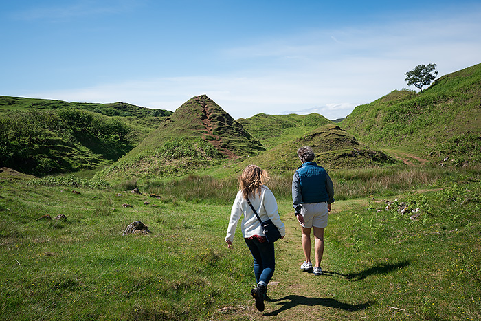 This 1 mile loop trail was easy to do. Allow an hour.

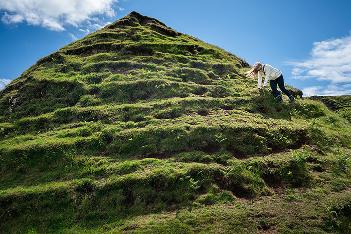
A diversion off trail…
We walked past conical hills and up a slight hill past ferns and gnarled trees…then spotted Castle Ewen, the fairy rock tower.

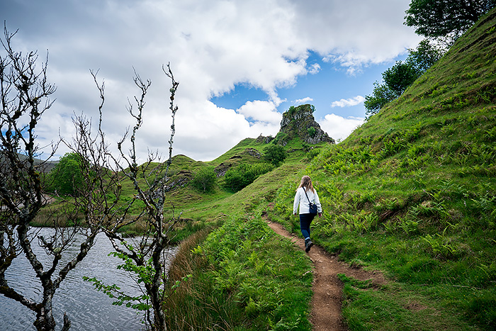
Once there, a short path takes you to the top of the rock tower in about ten minutes.

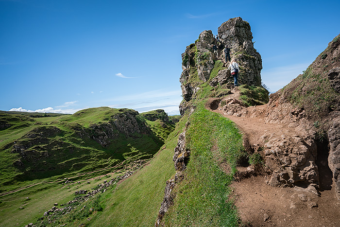
Hiking to Castle Ewen
But if you trip easily or are afraid of heights it can be a little tricky. And a bit unnerving on windy days. The steep rocky path gets congested when there’s more than 3 people.
Squeeze through the clefts to see panoramic views of the surrounding countryside.

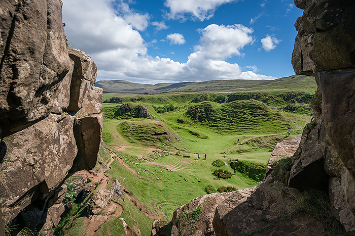
View from Castle Ewen
We didn’t spot any fairies or elves hiding in the crevices of their rock tower…

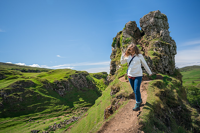
Watch out for wind!
Returning to the valley, we walked around the circular path at the base of the rock tower. Enthusiastic tourists–likely spellbound by this special place–created a fairy circle with stones collected from area farms. But locals don’t approve. They remove the stones when spotted.
A faint fairy circle still remains.

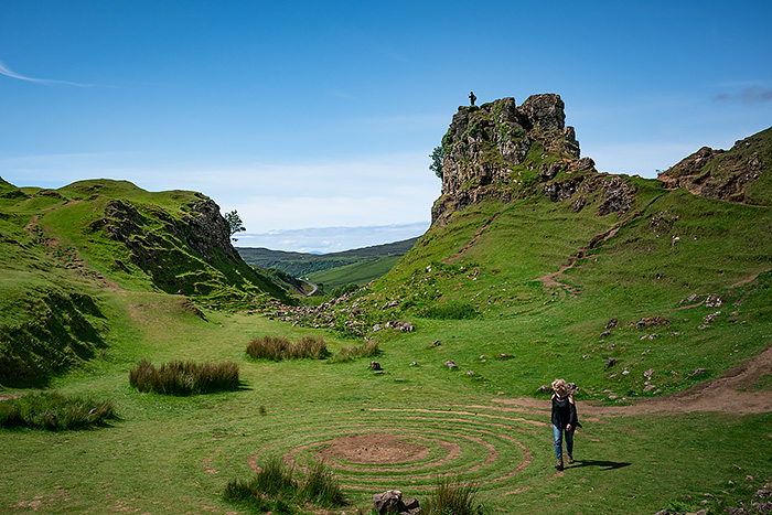 And I have to admit– it looks kinda fitting in this special place.
Old Man of Storr Hiking Trail
This is perhaps the most popular hike on Skye. Located 6 miles north of Portree, this trail is in the southern region of the Trotternish Peninsula, closer to the central part of the island. Expect parking spaces to fill quickly and the trail to be very crowded.
The 2.8 mile circular loop, rated moderate, takes around 2 hours to complete. However…attempting this in the rain or blustery wind makes it feels strenuous! My daughter and I hiked this on such a day.

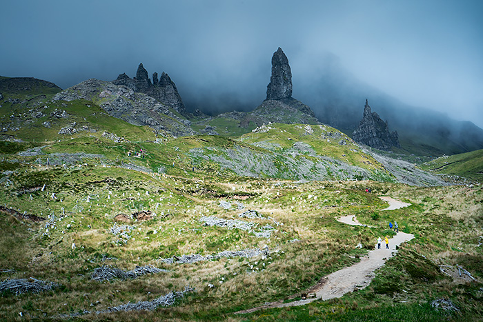 A light mist hung in the air as we started up the trail and continued up, up, up. The trail doesn’t appear steep, but we felt surprisingly winded the higher we climbed.

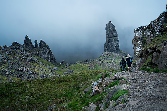
We struggled to ascend, fighting against an ever-increasing wind.

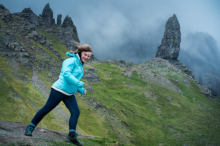
Reaching this spot, near the iconic Old Man rock pinnacle, took about an hour. Trying to hold my camera steady was impossible. The wind blew my 85mm lens with such force that I couldn’t take a picture unless I could brace my camera against a rock. So I only took a handful of images, since most of the trail was exposed.

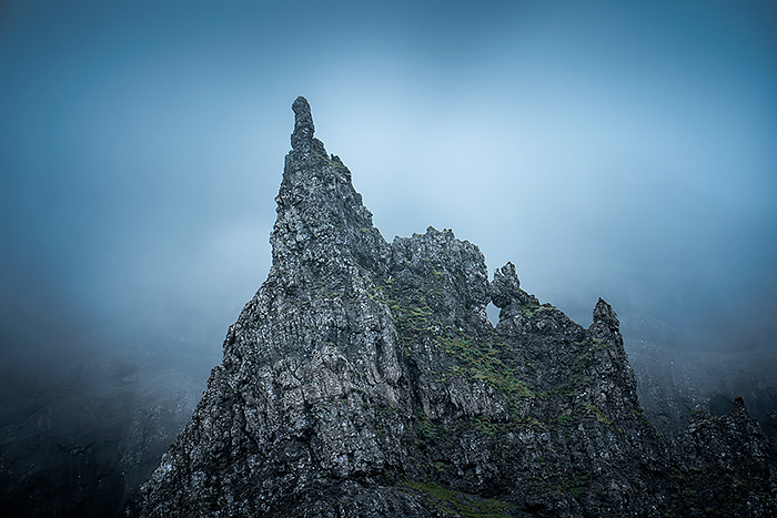
As the mist turned to rain, we noticed more and more tourists turning around and filing past us to head back down. The muddy trail was getting slick. And visibility was decreasing. We couldn’t see how far up the trail went before it looped around, so decided to backtrack our descent in the deteriorating weather.

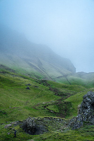
I really wanted to complete the loop and explore the area behind the rocky spires. We’ll try again, I told my daughter. After all, we padded our Skye itinerary with a buffer day for such endeavors. Maybe tomorrow will be clearer and calmer.
But alas. We were in Scotland— where frequent rains feed the gorgeous green scenery— but thwart hiking intentions.
No wonder the Gaelic language has over 8,000 Gaelic words for rain.
Dinosaurs!


Staffin Fossil Museum is a great little place to escape the rain. Look for a stone cottage along A 855 near the Free Presbyterian Church in Staffin on the eastern side of Trotternish Peninsula. Learn about the geology and see plaster casts of dinosaur prints, nodules, fossils, and artifacts found buried in peat bogs from this area.
Did you know that dinosaurs once roamed the Isle of Skye? Hadrosaurs, a common dinosaur during the Cretaceous period, had duck-bills with 960 teeth! They ran on two feet and used a stiff tail for balance.

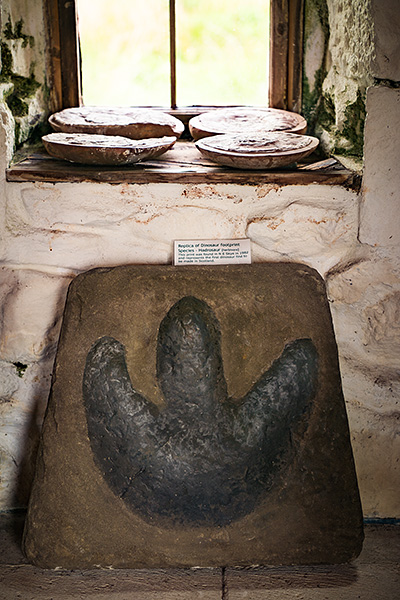
See Scotland’s first dinosaur footprint found on Staffin beach in 1982.
Septarian Nodules contain fragments of fossil shells and ammonites that formed inside clay concretions.

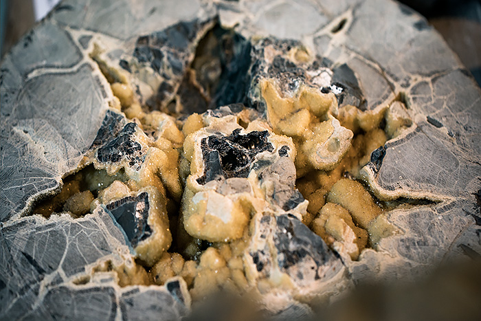
Dugald Ross, the curator of this one-room museum, started collecting these items when he was 15 years old. He’s often present and eager to talk about his findings and give directions to find the real dinosaur prints on An Corran beach (visible only at low tide). Museum costs £2.
Stop in at the Tea Pot next door for hot coffee or tea and yummy pastries. The owner also sells some lovely artwork–from framed photographs of impressionistic beach scenes to jewelry.
Inspiration & Ideas
I devoured this hand-held sized book! Chock full of ideas for 40 Coast & Country Walks on the Isle of Skye. You’ll find ideas for exploring caves, beaches with coral or dinosaur prints, standing stones and unusual ruins. It also shares the historical context or unique trivia about each place. Honestly, this is my favorite guide for Skye. Inexpensive gem!
Weather
Even though we visited in summer, the weather felt windy and cold. Bring warm layers that include fleece, a knit hat and gloves. And a raincoat! Forget umbrellas and hats, as both tend to blow off and away in the wind…
Driving
Driving was tricky due to congested traffic on the single track roads. Passing places exist– but are not necessarily understood by foreign tourists. Watch Youtube videos about how to drive in Scotland and on the Isle of Skye.
Expect longer travel time to cover short distances. Best to plan one major hike per day and get there early to secure a parking spot. Look out for sheep crossing the road as you zip around blind curves. Rent a small vehicle–it’s easier to keep it on the road. There are no shoulders to prevent tires from veering off the narrow lane into a boggy mess. Fill up in Portree or Uig when your tank is half empty.
Overall Impressions of Skye
So…was it worth the wait? Absolutely! I loved exploring the volcanic landscapes under dramatic, moody skies. Just wish we’d extended our time here a few more days and visited in the shoulder season instead of summer. But there’s always next time…hopefully before our golden anniversary!


